

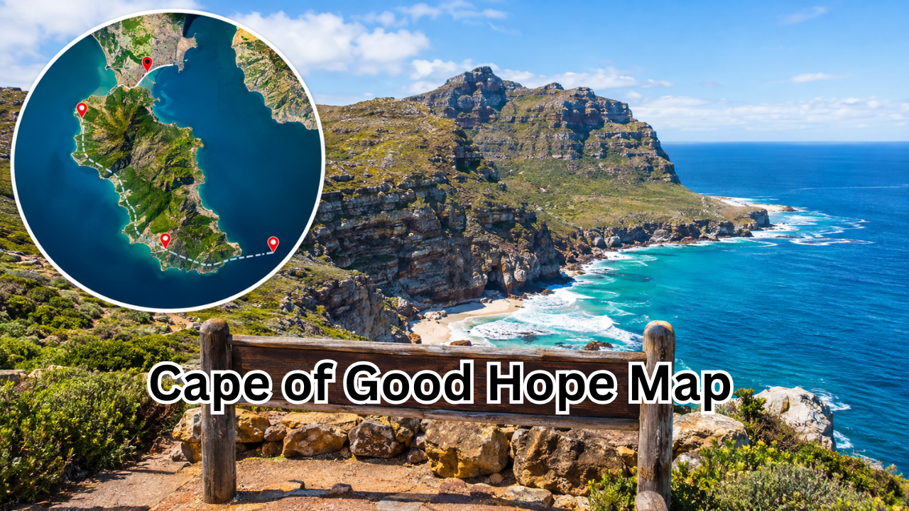
The Cape of Good Hope map is a useful way to understand one of South Africa’s most famous coastal landmarks. Located on the Cape Peninsula in the Western Cape province, the Cape of Good Hope is known for its dramatic cliffs, ocean views, diverse wildlife, and important place in maritime history.
Although many people think the Cape of Good Hope is the southernmost point of Africa, that distinction actually belongs to Cape Agulhas. The Cape of Good Hope is nevertheless an important geographical landmark because of its location near the southwestern tip of the African continent and its historic relationship with major sea routes.
A good map makes it much easier to understand where the Cape of Good Hope sits in relation to Cape Town, the Atlantic Ocean, False Bay, and other attractions on the Cape Peninsula. Whether you are planning a trip, studying geography, or simply curious about the region, learning how to read a Cape of Good Hope map can provide valuable context.
Where Is the Cape of Good Hope?
The Cape of Good Hope is situated on the southern end of the Cape Peninsula in South Africa’s Western Cape province. It forms part of the Table Mountain National Park and is approximately 60 kilometers from central Cape Town, depending on the route taken.
On a map, the Cape can be found along the peninsula that extends southward from Cape Town. The Atlantic Ocean lies to the west, while False Bay is located to the southeast and east.
The area is characterized by rugged coastline, rocky mountains, beaches, and open landscapes. Its position makes it particularly easy to identify on a regional map because the Cape Peninsula projects prominently into the surrounding ocean.
Cape of Good Hope Map and Its Surrounding Geography
Looking at a map of the area reveals several important geographical features. The Cape of Good Hope is not an isolated point but part of a larger protected coastal landscape.
Some of the most important nearby locations include:
- Cape Town
- Table Mountain
- Cape Point
- Simon’s Town
- Hout Bay
- False Bay
- Atlantic Ocean
- Cape Peninsula
- Cape Agulhas
Cape Point is especially important when interpreting maps of the region. It is located near the Cape of Good Hope and is another major landmark within the national park.
The two names are sometimes used interchangeably in casual conversation, but they refer to different geographical features.
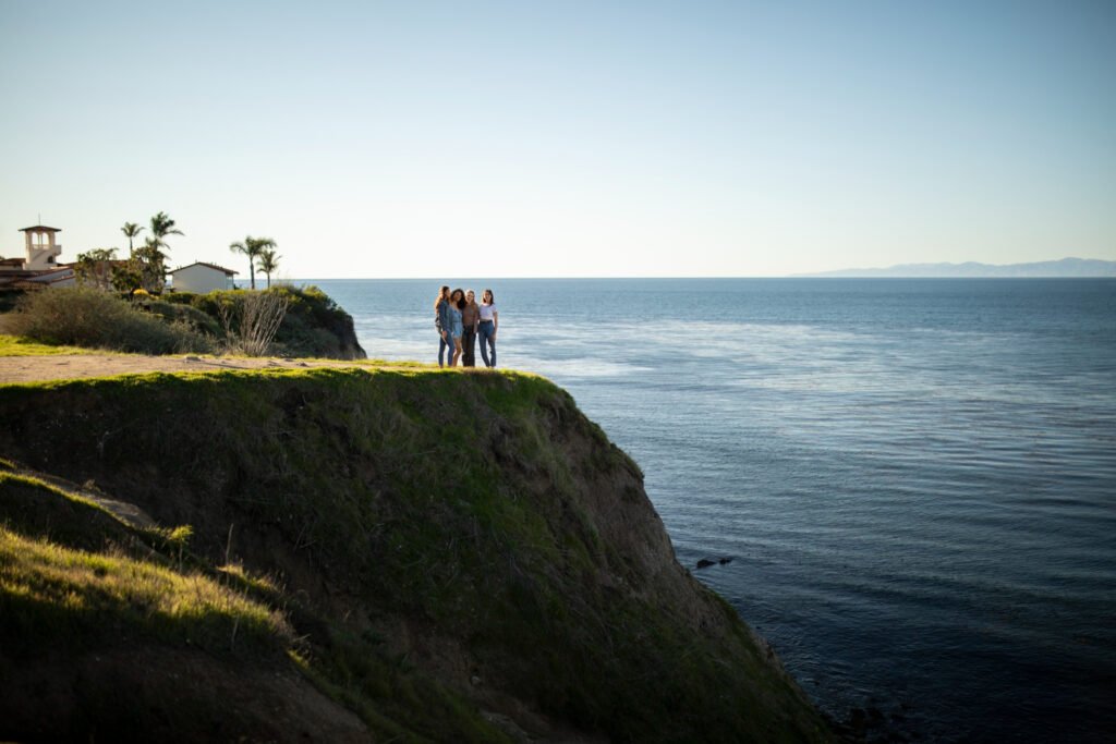
Cape of Good Hope vs. Cape Point
One of the most common sources of confusion is the difference between the Cape of Good Hope and Cape Point.
Cape Point is a prominent headland located near the southern end of the Cape Peninsula. The Cape of Good Hope is another headland farther west.
A map helps show their relative positions clearly. They are close enough that visitors can generally see both during the same trip, but they should not be treated as exactly the same location.
| Feature | Cape of Good Hope | Cape Point |
|---|---|---|
| Location | Southern Cape Peninsula | Near the southeastern side of the peninsula |
| Province | Western Cape, South Africa | Western Cape, South Africa |
| Protected area | Table Mountain National Park | Table Mountain National Park |
| Main attraction | Rocky coastline and historic landmark | Cliffs, viewpoints, lighthouse area |
| Ocean setting | Atlantic side | Near the meeting area of Atlantic and False Bay waters |
| Common confusion | Often mistaken for Cape Point | Frequently called the Cape of Good Hope |
Understanding this distinction is particularly useful when using a Cape of Good Hope map for travel planning.
Why Is the Cape of Good Hope Important?
The Cape of Good Hope has played a major role in the history of global maritime travel.
During the Age of Exploration, European sailors searched for sea routes connecting Europe with Asia. Sailing around the southern part of Africa became an important step for ships traveling toward the Indian Ocean.
The Cape was therefore associated with some of the world’s most significant maritime journeys.
Portuguese explorer Bartolomeu Dias reached the region in the late 15th century. He originally gave the area a name associated with storms, reflecting the challenging conditions encountered by sailors.
Later, King John II of Portugal gave it the name “Cape of Good Hope,” reflecting optimism about reaching a sea route toward India.
Today, the Cape remains an important historical landmark, even though modern shipping no longer depends on it in the same way.
Understanding the Cape of Good Hope on a Map
When viewing a Cape of Good Hope map, it helps to identify several reference points.
Cape Town
Cape Town is the major city closest to the Cape Peninsula. It is generally the starting point for visitors traveling to the Cape of Good Hope.
The city is located north of the peninsula, making it easy to understand the general direction of travel by looking at a regional map.
False Bay
False Bay stretches along the eastern side of the Cape Peninsula. Its large curved coastline creates a major geographical feature that is clearly visible on maps.
The bay is also known for marine wildlife and scenic coastal communities.
Atlantic Ocean
The western side of the Cape Peninsula faces the Atlantic Ocean. The strong coastal environment contributes to the area’s dramatic cliffs, beaches, and changing weather conditions.
Cape Agulhas
Cape Agulhas is located farther southeast and is important because it is officially recognized as the southernmost point of Africa.
This is an important distinction when reading maps. The Cape of Good Hope is famous for its position at the southwestern end of the continent, but it is not Africa’s southernmost point.
Cape of Good Hope and Cape Agulhas: What’s the Difference?
The two locations are often confused because of their proximity within the broader southern Cape region and their connection with the Atlantic and Indian Ocean systems.
The Cape of Good Hope is on the Cape Peninsula near Cape Town. Cape Agulhas is considerably farther southeast.
A map of southern Africa makes the difference obvious.
Cape Agulhas is the geographic point where the southernmost land of the African continent is located. The Cape of Good Hope, meanwhile, is better known for its historical importance and spectacular coastal scenery.
For travelers, this distinction can prevent confusion when planning an itinerary.
Wildlife You May See Near the Cape of Good Hope
The Cape of Good Hope is part of a protected natural environment, and its wildlife is one of the area’s major attractions.
Visitors may encounter animals such as:
- Cape baboons
- Eland
- Ostriches
- Rock hyraxes
- Various seabirds
- Antelope
- Marine mammals in surrounding waters
The area is also associated with a rich marine ecosystem. Depending on the season and location, visitors may have opportunities to observe whales and other marine life from coastal viewpoints.
Baboons are particularly well known in the Cape Peninsula. Visitors should never feed or approach them because they are wild animals.
Natural Landscape of the Cape of Good Hope
The landscape around the Cape is shaped by mountains, ocean, wind, and a distinctive type of vegetation known as fynbos.
Fynbos is a major component of the Cape Floristic Region, one of the world’s important areas of plant diversity. Despite its relatively small geographic size, the region contains an extraordinary variety of plant species.
This means a Cape of Good Hope map represents more than just a tourist destination. It also points to an ecologically significant part of South Africa.
The combination of mountains, coastal cliffs, beaches, and vegetation gives the region its recognizable appearance.
Best Ways to Use a Cape of Good Hope Map
A map can be especially useful before and during a visit.
If you are planning a trip, use a map to understand:
- The distance between Cape Town and the Cape Peninsula.
- The location of Cape Point relative to the Cape of Good Hope.
- The position of False Bay.
- Major roads leading into the protected area.
- Nearby coastal towns.
- Scenic viewpoints and walking areas.
- Other attractions that can be combined with a day trip.
It is also useful to check the route before leaving because travel times can vary depending on traffic, road conditions, weather, and stops along the way.
Popular Attractions Near the Cape of Good Hope
A trip to the area can include much more than the famous Cape itself.
Cape Point
Cape Point is one of the most recognizable attractions in the region. Its dramatic cliffs and elevated viewpoints provide impressive views across the surrounding coastline.
Boulders Beach
Boulders Beach, near Simon’s Town, is famous for its African penguin colony. It is one of the most popular wildlife stops on the Cape Peninsula.
Simon’s Town
Simon’s Town is a historic coastal settlement located along False Bay. It can make a convenient stop when exploring the peninsula.
Table Mountain
Table Mountain dominates the skyline of Cape Town and is one of South Africa’s most recognizable natural landmarks.
Although it is north of the Cape of Good Hope, it provides useful geographical context when looking at a broader map of the peninsula.
When Is the Best Time to Visit?
The best time to visit depends on what you want to experience.
Summer generally brings warmer and drier conditions, making it attractive for sightseeing and outdoor activities. However, strong winds can occur around the Cape, and conditions can change quickly.
Winter can bring cooler temperatures and more rainfall, but it can also provide beautiful clear days.
Spring is particularly appealing for people interested in plants and landscapes because parts of the Western Cape become vibrant with seasonal wildflowers.
Regardless of the season, checking local weather conditions before visiting is a smart idea.
Tips for Exploring the Cape of Good Hope
A little preparation can make a visit much easier.
Consider these practical tips:
- Start early if you want to see several attractions in one day.
- Bring water, especially if you plan to walk.
- Wear comfortable shoes for uneven paths.
- Carry sun protection even when temperatures feel mild.
- Keep food away from wild animals.
- Follow signs and instructions inside the protected area.
- Allow extra time for scenic stops.
- Check current opening information before traveling.
- Keep an offline map available if mobile reception becomes unreliable.
The weather deserves particular attention. Coastal conditions can be windy even when Cape Town itself feels relatively calm.
Why Maps Are Useful for Students and Travelers
A Cape of Good Hope map can be useful in several different contexts.
For students, it provides a practical example of coastal geography, landforms, maritime routes, and the relationship between physical geography and human history.
For travelers, a map helps organize an itinerary and understand distances.
For history enthusiasts, the location provides context for the development of maritime routes between Europe, Africa, and Asia.
Maps are also helpful for understanding why the Cape became such an important landmark during centuries of ocean exploration.
Frequently Asked Questions
Is the Cape of Good Hope the southernmost point of Africa?
No. Cape Agulhas is officially the southernmost point of Africa. The Cape of Good Hope is located farther west on the Cape Peninsula and is famous for its historical and geographical importance.
Where is the Cape of Good Hope located?
The Cape of Good Hope is in South Africa’s Western Cape province, on the southern portion of the Cape Peninsula. It is part of Table Mountain National Park.
Is Cape Point the same as the Cape of Good Hope?
No. Cape Point and the Cape of Good Hope are separate geographical features located close to each other. A detailed map makes their positions easier to distinguish.
How far is the Cape of Good Hope from Cape Town?
The Cape of Good Hope is roughly 60 kilometers from central Cape Town by road, although the exact distance depends on the route and starting point.
Can you visit the Cape of Good Hope?
Yes. It is a major visitor attraction within the protected Cape Peninsula landscape. Travelers can explore viewpoints, coastal scenery, walking routes, and nearby attractions.
Why is the Cape of Good Hope historically important?
The Cape became an important landmark during the Age of Exploration because ships traveling between Europe and Asia sought routes around the southern tip of Africa. Its location made it an important reference point in maritime history.
Final Thoughts
A Cape of Good Hope map provides much more than a simple indication of where the landmark is located. It helps explain the geography, history, wildlife, and tourism of one of South Africa’s most recognizable coastal regions.
By looking at the Cape in relation to Cape Town, Cape Point, False Bay, the Atlantic Ocean, and Cape Agulhas, it becomes easier to understand why the region has attracted explorers, travelers, historians, and nature lovers for centuries.
Whether you are researching the area for a school project or preparing for a visit, a reliable map is one of the best tools for getting familiar with the Cape Peninsula. Just remember the key geographical distinction: the Cape of Good Hope is a famous southwestern landmark, while Cape Agulhas holds the title of Africa’s southernmost point.
Also Read : YouTube to MP3: A Complete Guide to Converting YouTube Videos to Audio











Leave a Reply